Lost Coast, found treasure
waves crash, sea lions grunt, cobbles roll
forest, sand, surf meet
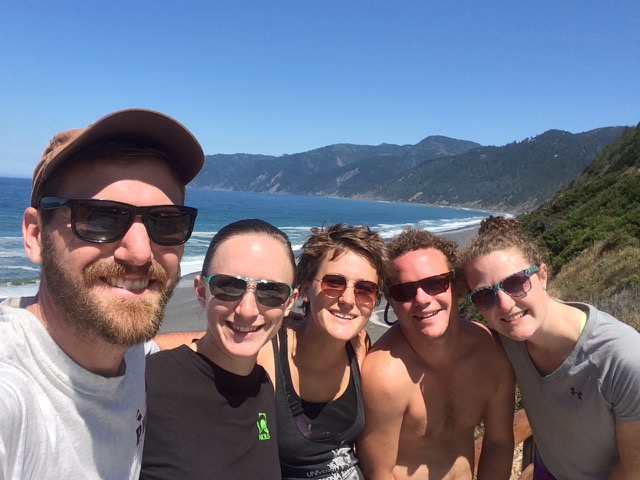
This time last week, I was hiking the Lost Coast trail, a 24.6 mile stretch of seaside and beach trail in the King Range National Conservation Area, which is managed by the BLM Arcata Field Office. Whenever anyone would ask how it was, my synopsis was this: “It is unreal how beautiful the Lost Coast is.” Not the most elegant phrasing, but the honest truth. Enjoy the pictures my friends, and if you like to backpack, put this trail on your bucket list.
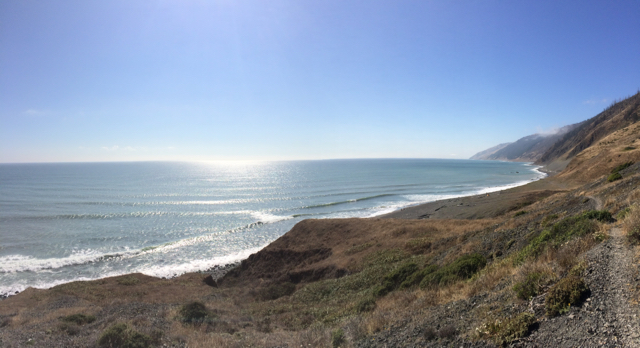
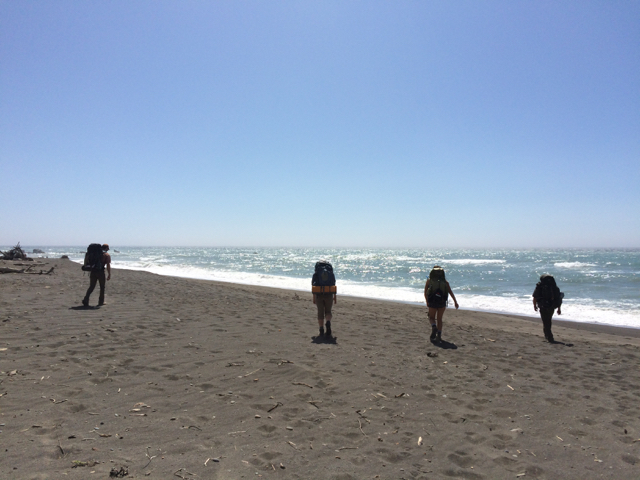
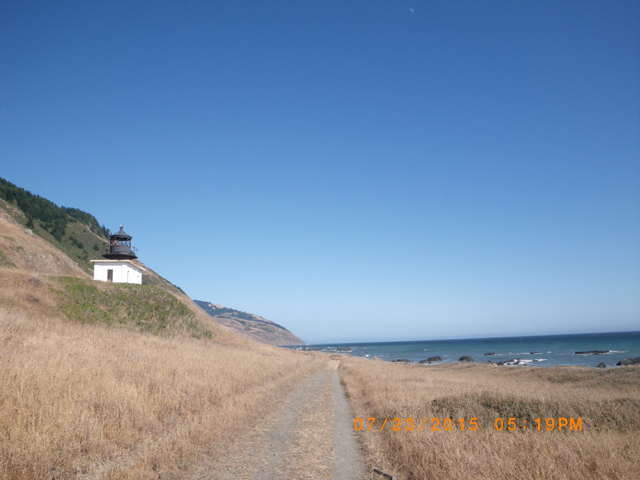
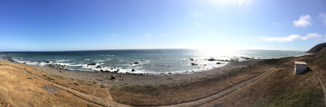
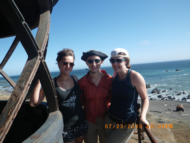
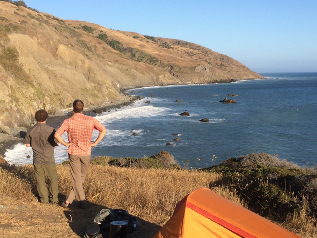
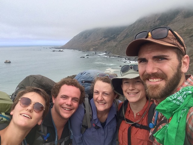
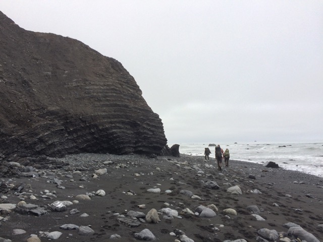
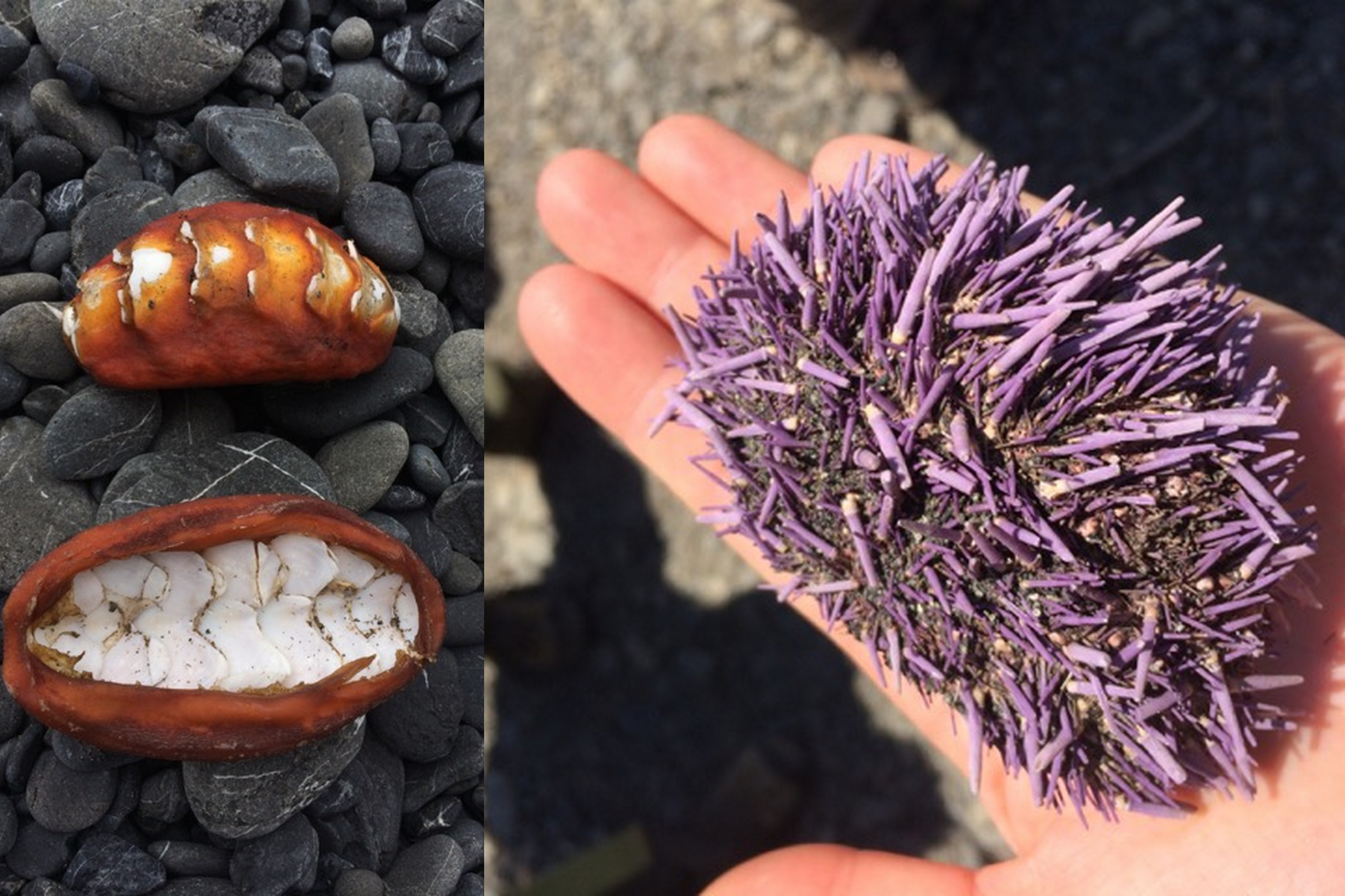
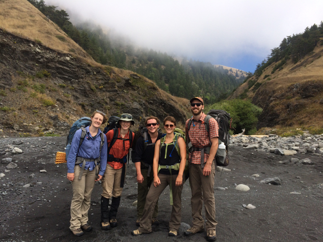
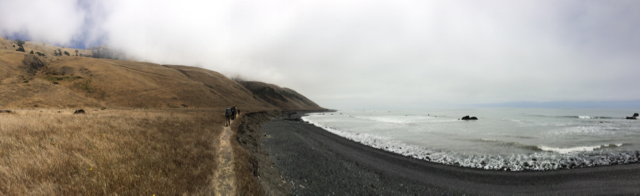
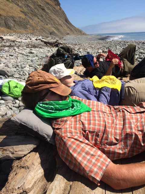
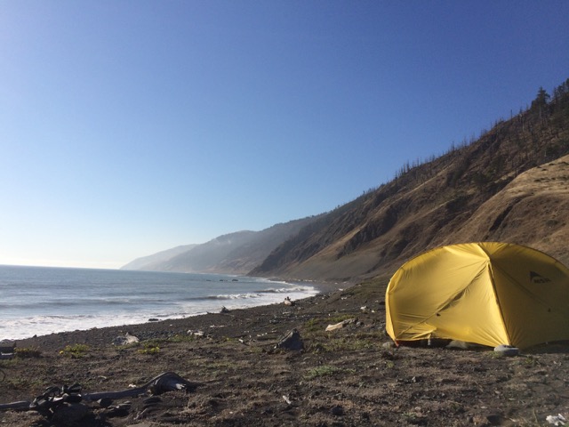
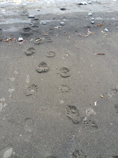
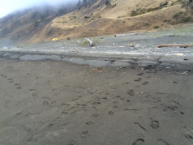
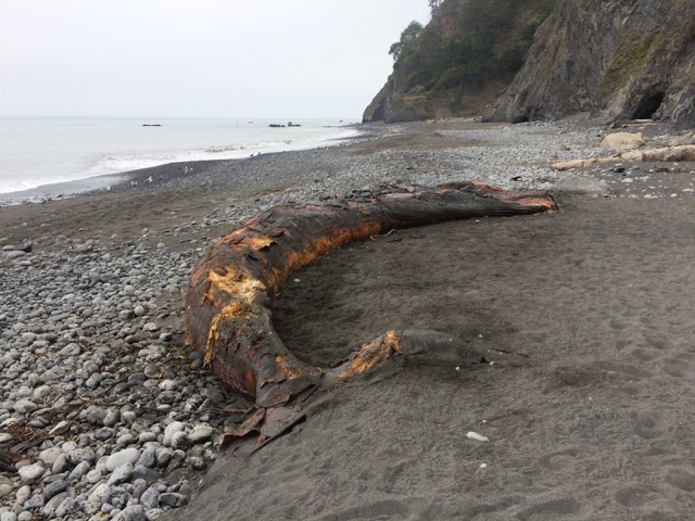
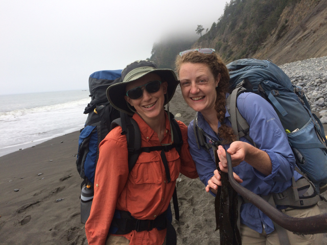
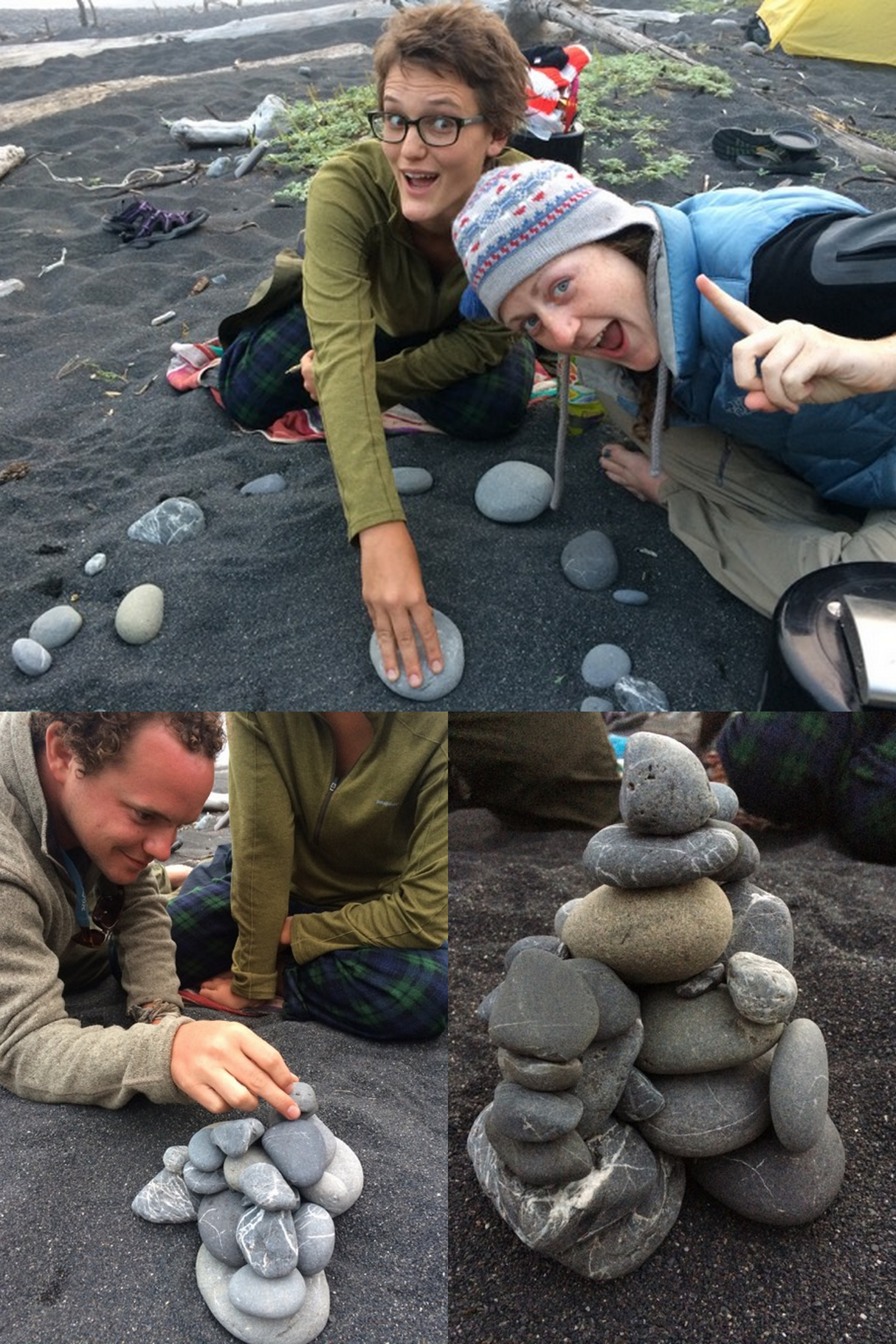
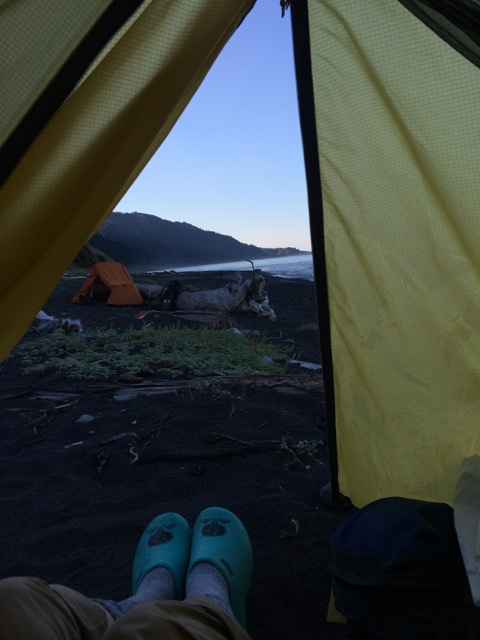
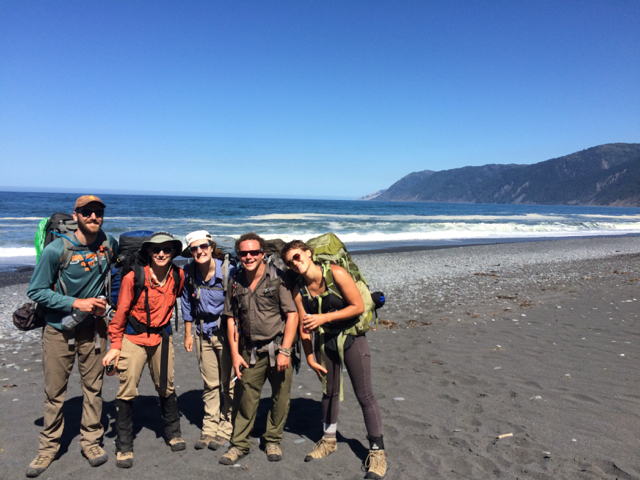
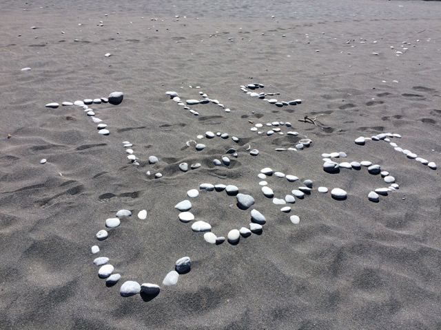
The hike begins from the Mattole Trailhead. We have our self-issue permit and bear canisters, and we are ready to go!Our first major landmark was the Punta Gorda lighthouse, also known as the “Alcatraz of lighthouses,” which was in use until 1951.The lighthouse was “open” to visitors, by which I mean, you could climb up to the top – and take panoramic photos.Ladies of the lighthouse! Floppy hat catching some wind.After exploring the lighthouse, we journeyed on to our fist campsite.First night campsite on a small hill above a freshwater creek that flows into the ocean. We could see and hear sea lions on the offshore rocks below.This cobblestone beach was where we started our second day of hiking, it was immediately below the cliff in the picture above. Hearing the waves crash upon the shore then toss and roll the cobblestones over each other is a sound I will not forget.Group pic! Our campsite from the first night is in the background.Back to the beach to continue the hike. It was neat to see the exposed folds in the rock along the shore.Deceased sea creatures were inevitable while hiking on the beach; we saw chiton (left) and sea urchins (right), as well as crabs and shells of other things long gone.Posed in front of one of the many freshwater streams that flow into the ocean.Still unreal.Any good camping trip needs a good nap time. We found a giant piece of drift wood to rest our weary bodies upon.Second night campsite, just a stone’s throw from the surf.We had a visitor in the night – BEAR!It was THIS close! (Yellow dot in upper left is my tent.) Good thing we followed the regulations and had our food and smelly things in our bear canisters.On the third day, the trail called and we followed. This is a picture from the second (of two) high-tide impassable sections on the trail.We saw (and smelled) a dead whale! Probably a young gray whale.Kelp-ie stick photo!Third night campsite, we crept closer to the ocean each night. I waited a little too long to take this picture, and thus you see the effect of the north coast fog.On the third and final camping night, we played rock stack, which is exactly what it sounds like and more fun than you may be imagining. Look at our creation!With my Bandito camp shoes on, I greeted the morning of our final day on the Lost Coast.About a half mile from the finish, we received some trail magic – three beers to share among ourselves AND someone to take our picture. The home stretch!We made it! Slightly cleaner and in high spirits, we prepared to depart the Black Sands Beach trailhead in Shelter Cove.I am already dreaming of my next visit!
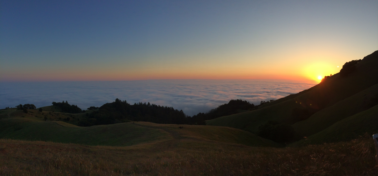
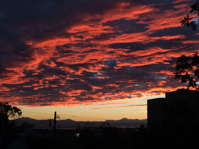
This is one of the most stunning sunsets I have ever seen. We were situated above the coastal fog, approximately on O’Rourke’s Bench in Mt. Tamalpais State Park. Phenomenal.
Sea of fog sunsets Point Reyes falls, seals, lighthouse
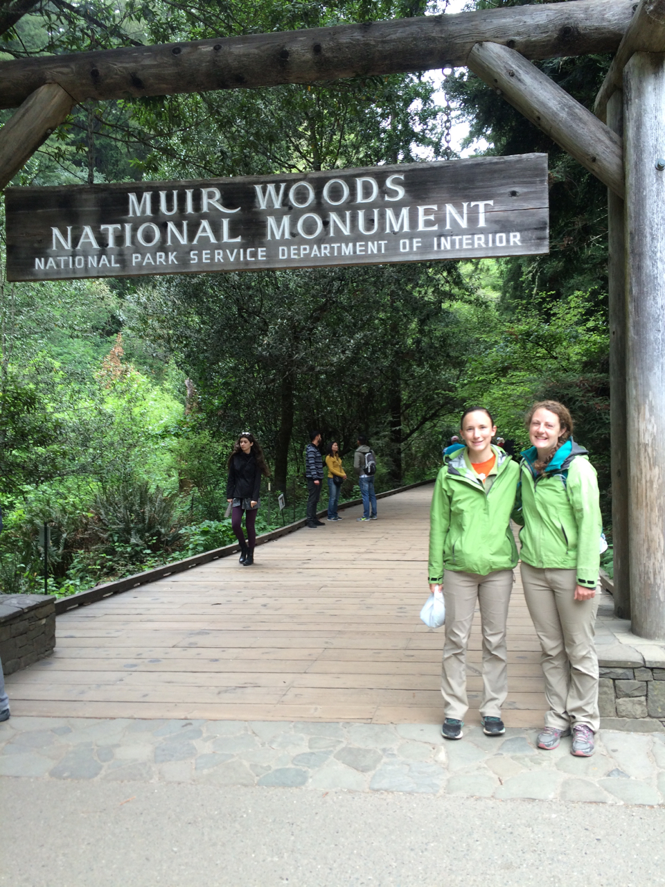
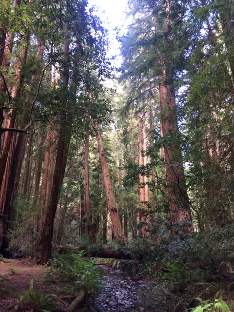
Muir Woods sky-scrapers
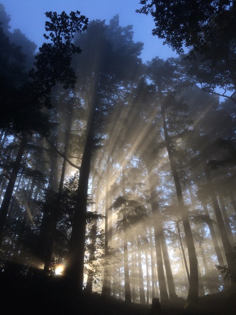
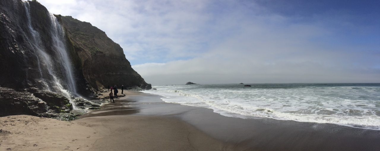
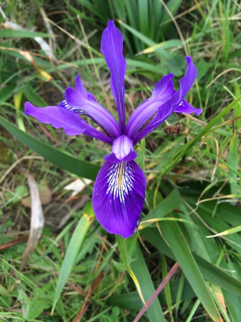
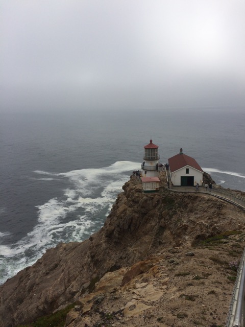
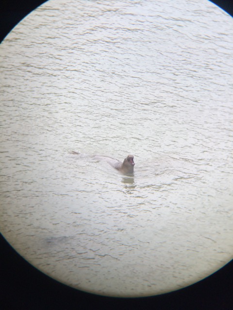
As if we had not been spoiled enough, we were treated to this gorgeous view out of our tent on Saturday morning at the Pantoll campground in Mt. Tamalpais State Park.Our Saturday adventure began with a seven-ish mile hike along the coast at Point Reyes National Seashore.Our destination was Alamere Falls, a waterfall into the ocean. California really does have it all.We made it!Throughout the park, we encountered an abundance of blooming wildflowers. The Douglas iris (pictured here) was particularly stunning.In the afternoon, we journeyed across the park to see the Point Reyes Lighthouse. For the physics buffs out there: the Point Reyes Lighthouse is a “first order” Fresnel lens, and its inner workings are particularly display-worthy because they originally debuted at the 1867 Paris World’s Fair.Our final park stop was to see the elephant seals. This is a picture through a binocular of one of the male elephant seals calling. It was a rather amusing sound.Day two of our adventure led Laura and I to Muir Woods National Monument. Yes, we are wearing matching rain jackets and pants; we bought the rain jackets separately.There is something captivating about these trees. For the botany enthusiasts, these are the coastal redwoods (Sequoia sempervirens). You will see a picture of another of the “redwoods” in the next section.Walking among giants
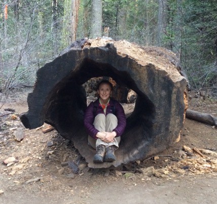
GIANT sequoias Rim Trail, peep s’mores, & dyed eggs
Sippin’ the good life
In early April, a group of us went to see the “Big Trees” of Calaveras State Park in Arnold, California. The “Big Trees” are giant sequoias (Sequoiadendron giganteum), and no picture can do them justice, you will have to come see them for yourself.
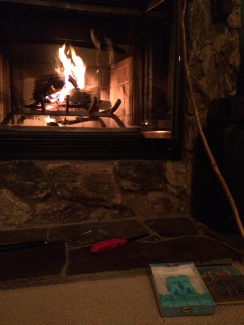
Walking along the North Grove Trail was akin to walking through an adult-sized jungle gym made of tree parts past and present. Look how big they are!On day two, David and I hiked a 10-mile section of the Arnold Rim Trail. Here I am at the Top of the World.At night, we refueled and rewarded ourselves with peep s’mores, which are like a traditional s’more, but with the marshmallow replaced by a peep! Before you dismiss the idea, try it: it’s all about the caramelized sugar.Easter coincided with our trip and to celebrate, we dyed eggs. I think that one is looking at you!
Cache Creek backpacking
Rolling trail, wild blooms, critters
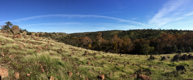
Vast oak savanna
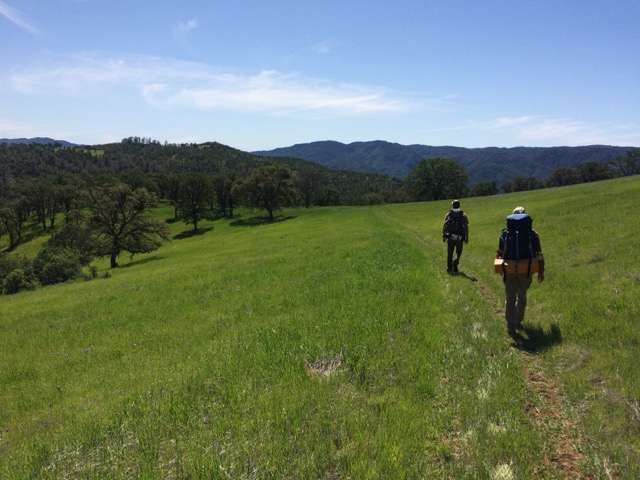
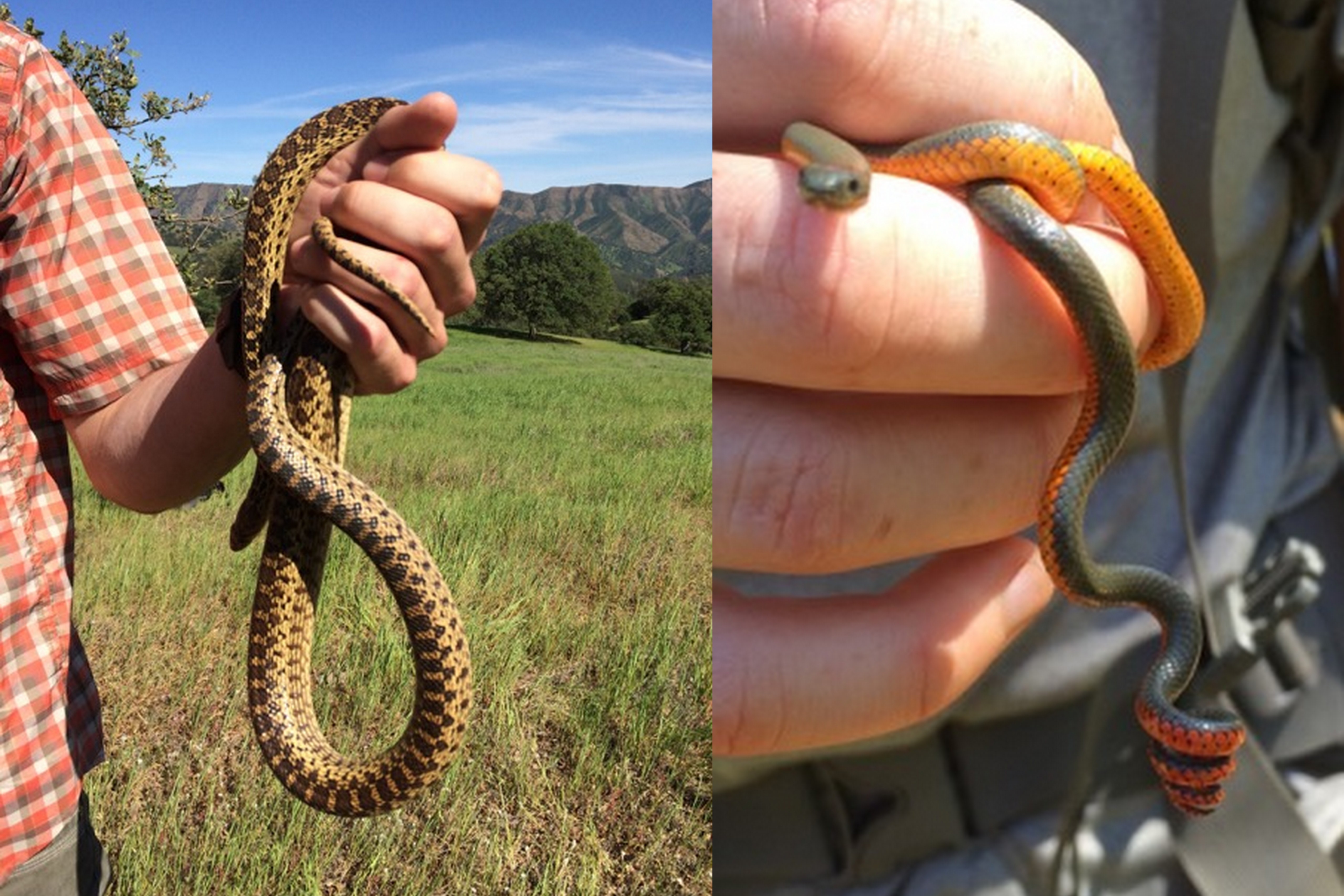
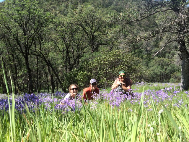
The last weekend of March, three of us went on our first backpacking trip of 2015. Our travel destination was Cache Creek Natural Area, a 70,000+ acre expanse of BLM land. For our adventure, we selected the 10-mile Ridge Trail hike, which meandered through oak savannas and the occasional stretch of chamise chaparral. It was a beautiful trip full of wildflowers and animal sightings, the latter of which included a coyote, a gopher snake, a ring-necked snake, a squirrel, and more lizards than I could count.
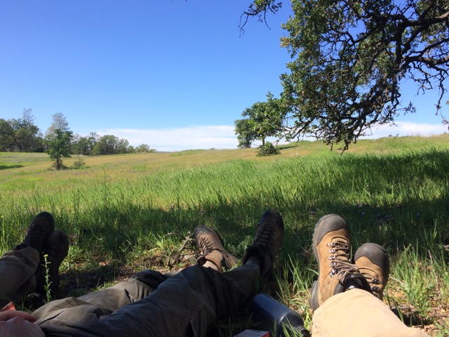
Sometimes the best way to celebrate trail life is with a shady nap.Dinner never tastes so fine as when it comes at the end of a 10-mile hike and is made over a camp stove. Here we are enjoying pita pizzas.Wildlife sightings/catchings: gopher snake left and ring-necked snake right.Happy crew nearing the end of our trek – what a weekend!
*Weekend Warrior endnote: hopefully now it is clear why there have been a dearth of posts. This blog is still something I intend to keep up, but the spread between posts might continue at the current pace. Thank you for reading!
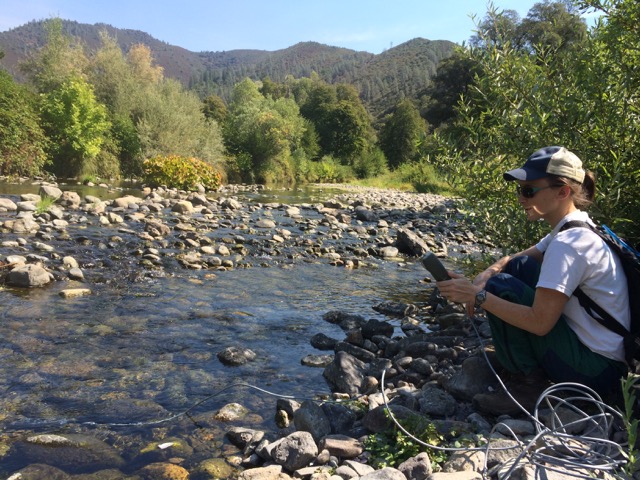
Looking down from a ridge toward Paynes Creek. 14.11.24
Natural beauty
of Northern California –
the place I call “home.”
This post is really about the pictures. Before I moved, my east coast friends would ask me where I was going, and I would tell them Redding, California. They replied with a blank look. Then I would say “it’s in Northern California,” and the immediate response was: “Oh, it’s beautiful!” They spoke the truth.
I have included the dates because this is also a celebration of California weather.
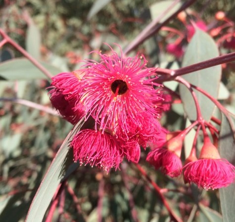
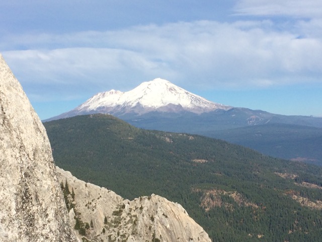
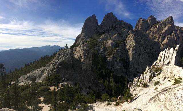
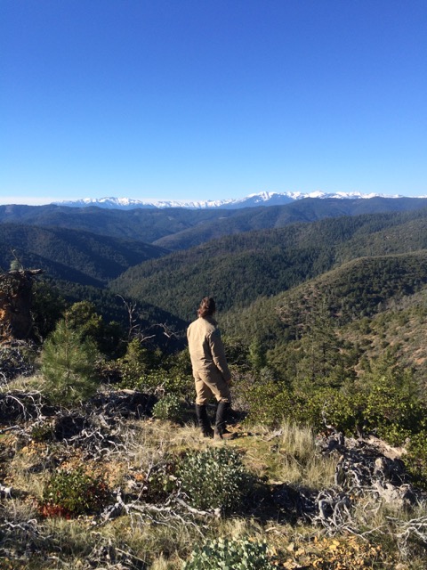
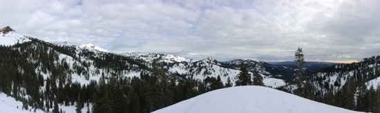
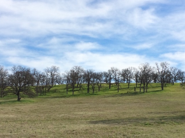
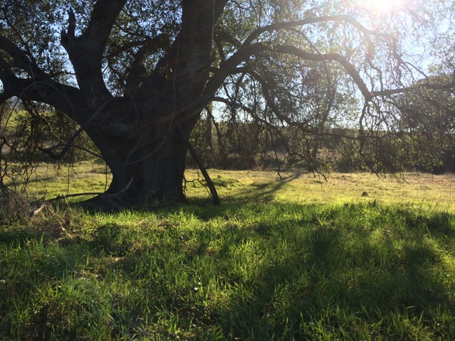
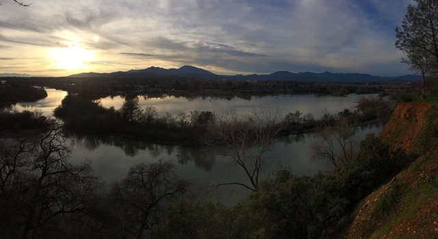
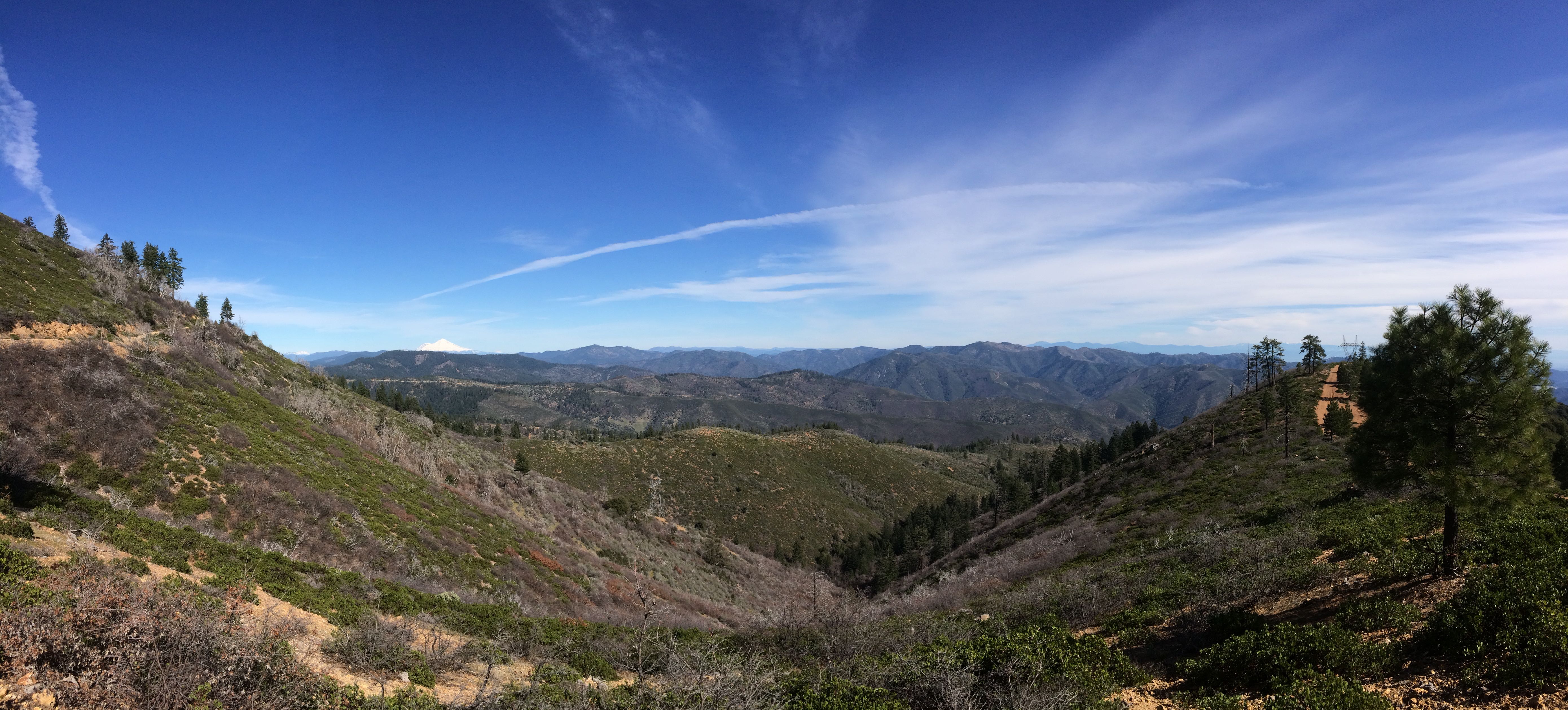
First week on the job! 14.9.11Sunrise from my apartment 14.10.24Eucalyptus flower at the Sacramento Bend River Outstanding Natural Area (aka “the Bend”) 14.11.17Mt. Shasta from Castle Crags 14.11.11Castle Crags 14.11.11Looking west from the Chappie-Shasta OHV area toward the Trinity AlpsCoyote Pond at the Bend 15.1.6Snowy Lassen Volcanic National Park – from my first adventure snowshoeing 15.1.10Oak savanna at the Bend, never gets old 14.2.10Oak 15.1.22Sacramento River and Redding 15.2.11Valley view 15.2.19I live here! (If you look closely, you can see Mt. Shasta in the upper third of the photo) 15.2.19